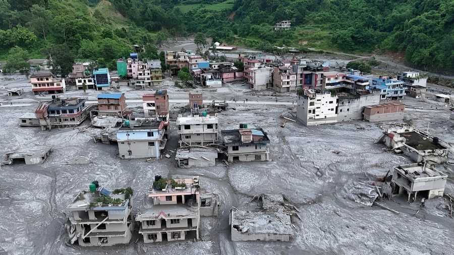
On the morning of August 26, 2026, global seismometers suddenly spiked, registering an energy signature equivalent to a magnitude-5.2 earthquake. In the narrow river valleys slicing through the Nepal-China border, the earth didn't just shake; it roared. Within minutes, a monstrous, pitch-black wall of water, pulverized ice, and ancient boulders walloped the Gyirong checkpoint and pulverized the historic "Friendship Bridge."
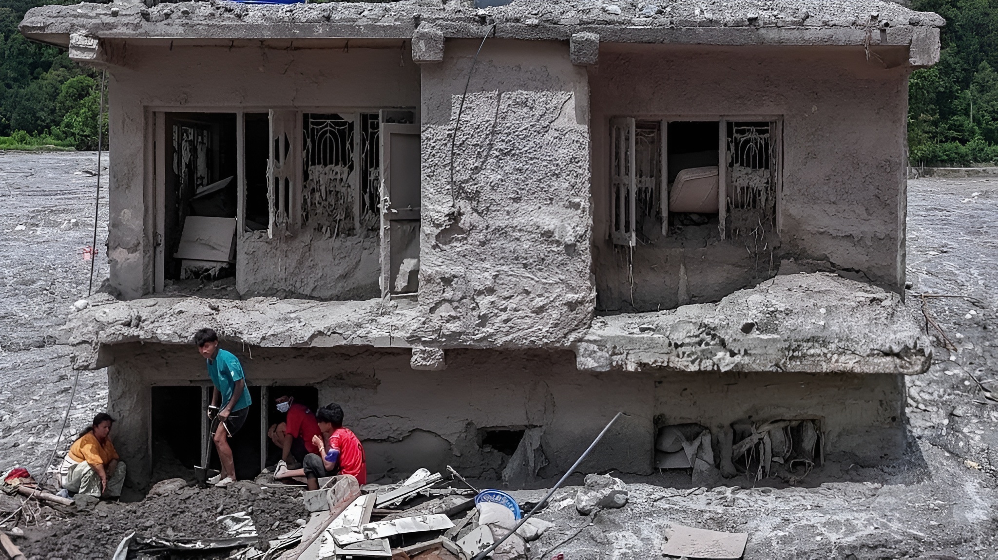
Rivers like the Lhende Khola, Bhote Koshi, and Trishuli swelled by an unbelievable nine meters (nearly 30 feet) in just 30 minutes. As per the reports, entire villages in the Rasuwa, Nuwakot, and Gorkha districts were erased from the map. With the official death toll climbing past 1,100 people and more than 4,000 still missing, the world is left asking one harrowing question, “What could possibly generate enough liquid fury to alter the Himalayan geography in under an hour?”/
The Obvious Culprits That Weren't
When news of the disaster first broke, local media and global observers jumped to a logical conclusion of Glacial Lake Outburst Flood (GLOF). The region had been heavily monitored by groups like the International Centre for Integrated Mountain Development (ICIMOD) because climate change has notoriously caused high-altitude glacial lakes to swell to bursting capacity. Just a year prior, in July 2025, a classic GLOF had struck the exact same river system.
Alternatively, early rumours blamed a tectonic earthquake for fracturing a hidden dam. For the first 24 hours, the narrative claimed that a weak, a climate-swollen lake had naturally given way under monsoon rains.
But as satellite imagery cleared and geologists dove into the seismic data, that clean misconception fell apart completely. No cataloged glacial lake had actually burst. In reality, the real culprit was far more complex, unexpected, and terrifying.
Also Read: The World's Most Beautiful Libraries You Need To Visit
The Race To Decipher The Mud
The mystery deepened as the sheer scale of the hydrology baffled experts. “What is hard to reconcile is the gargantuan volumes of water that we see in these horrific videos,” noted Daniel Shugar, a prominent geologist at the University of Calgary.
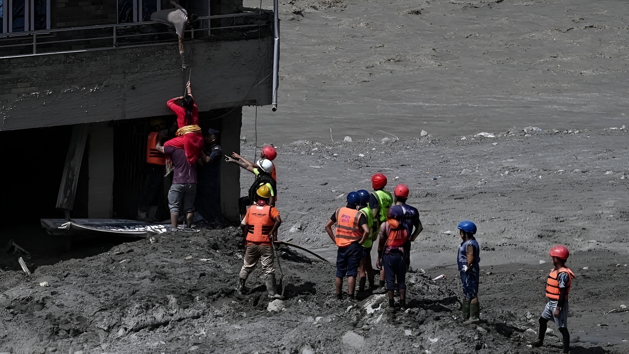
The tension intensified on the ground. Tens of thousands of emergency personnel battle relentless monsoon rain to excavate hydropower tunnels and buried homes. Meanwhile, scientists hurdle over communication platforms like Slack, racing to analyse data from the U.S. Geological Survey (USGS) and European Sentinel Satellites. They knew that if they couldn't figure out what triggered the surge, they couldn't predict if a secondary wave was looming over the surviving rescue crews downstream.
The data presented a horrifying paradox:
• The flood zone was bone-dry of major water bodies just hours before.
• Yet, the debris flow moved at an astonishing bullet-like speed of 193 kilometres per hour (120 mph).
The Anatomy Of A Hybrid Cascade
The riddle was solved when scientists pinpointed the steep, unforgiving slopes near Mountain Langtang Lirung (7,234 meters) within Nepal’s Langtang National Park.
The USGS report and planetary scientists unveiled a catastrophic multi-stage chain reaction:
The Permafrost Thaw And Massive Slope Failure
The disaster did not start with water; it started with failing rock. Decades of rising temperatures, with the Himalayan region warming by a staggering 1.8 degrees celsius, had melted deep permafrost. This permafrost acts as the geological “glue” holding the high mountain together. At approximately 10:50 a.m, a massive block of bedrock at an altitude of 5,200 meters sheared off, dragging a chunk of an overlying glacier with it.
The Kinetic Melting Matrix
As this gargantuan mass of rock and ice plummeted down the vertical face, the physics changed. The sheer kinetic energy and friction of the fall generated enough heat to pulverize and instantly melt the ice. It transformed a solid avalanche into a highly pressurized, liquid slurry of rock-melt before it even hit the valley floor.
The Natural Debris Dam And Burst
The avalanche slammed into the Lende Khola river corridor. Due to the ongoing monsoon season, the canyon soils were already completely waterlogged. The hurtling avalanche picked up this hyper-saturated sediment like a snowball, growing exponentially in volume. It briefly dammed the river channel, causing a massive, frantic pool of water to back up in minutes. Under the immense weight, the temporary debris dam failed violently, releasing a catastrophic “tsunami of dirt” that swept 100 kilometres downstream.
A Grim Warning And The New Normal
For years, international climate funding and early-warning networks were hyper-focused on monitoring visible glacial lakes. The tragic takeaway of the Langtang Lirung collapse is that high-altitude mountains are destabilizing from the inside out.
As Nepal’s Prime Minister Balendra Shah emphasized during emergency declarations, this disaster sends a stark message regarding climate justice to global climate forums; mountain nations are bearing the full impact of industrial emissions they did not create.
Traditional early-warning systems designed for slow-rising monsoon waters are obsolete against 190 km/h rock-ice slurries.
To prevent future cascades from turning into human catastrophes, regional governments and international bodies must transition from reactive rescue to proactive resilience.
Also Read: Scarcity Marketing: How Limited Edition Drive Sales
Key Actionable Initiatives for Alpine Disaster Prevention
Cross-border resilience begins with establishing automated, tri-national hazard telemetry networks that directly link China, Nepal, and India along transboundary river basins like the Lhende Khola and Bhote Koshi.
By installing real-time sensor sharing protocols, any sudden upstream flow disruption or water displacement in Tibet can instantly send automated evacuation warnings to communities miles downstream in Nepal and northern India.
Because surface-level observation misses deep structural mountain decay, monitoring strategies must expand beyond visible glacial lakes through advanced satellite synthetic aperture radar (SAR) and high-altitude remote sensing.
These tools track deep permafrost degradation, thermal stress, and millimeter-level slope deformations in high-altitude bedrock above 5,000 meters long before a physical detachment occurs.
To catch high-speed avalanches before physical floodwaters arrive, early-warning networks must deploy specialized ground-vibration acoustic and infrasound sensor arrays near high-risk Himalayan peaks.
These instruments detect the unique, low-frequency seismic signature of a rock-ice mass shearing off the moment it detachment happens, buying vulnerable valley settlements up to twenty crucial minutes of advance warning time. Severe structural overhaul is also mandatory for civil infrastructure and energy assets lining vulnerable mountain corridors.
Hydropower engineering along active river channels must incorporate reinforced flood-barricade doors, vertical emergency escape shafts above maximum inundation levels, and strict building setback zones to protect both power infrastructure and tunnel workers.
Finally, emergency communication must bypass fragile local infrastructure through automated cell-broadcast technology directly tied to upstream river-gauge triggers. Instead of relying on vulnerable local cell towers or manual phone calls, high-priority geo-targeted sirens and override alerts can instantly broadcast to every mobile device across the hazard zone the moment an anomaly is detected.
The 2026 flood has rewritten the rulebook of alpine geology, proving that in a rapidly warming world, even solid mountain peaks can turn to liquid without warning. While we cannot stop high-altitude slopes from giving way, cross-border intelligence, modernized early warnings, and resilient engineering can stop natural hazards from becoming human tragedies.